#Free Time City Drawing
1 messages · Page 1 of 1 (latest)
Got bored; started drawing
Haven't done so in a while
I think I'm settling for 2 cm per km, I usually draw from decently far out
The biggest hurdle I have is scaling
I was much lazier in earlier times in making blocks
Used to do a sort of haphazard cross-hatching in between collectors, which made pint-sized blocks all the time
This made my junctions seem massive
In more recent times, my street layout has become more precise
Making drawing a more meticulous process, but with the reward of more consistent scaling
I was looking at Atlantic City/Ocean City in making this
With the main city being on a thin seashore strip
And then there's a marshy estuary behind with smaller towns on the mainland
I think I'll only have the two expressways on the map
And I think I'll start by sketching on paper, then scan it and attempt to colour it digitally somehow

The top island I drew on the shore kinda reminds me of a vertical Long Island 
The similarities are coincidental though
This is amazing
Thanks
1 island down

A different area
After a couple more km², some more cul-de-sac developments will dominate with pockets of organised grids round rail transit stops

Another corner (mostly) sorted!
I kinda forgot about rails doe 💀
So the faint parallel lines are just corridors to draw in rails later
I wasn't thinking of them in the densest areas since I assumed they'd probably just be buried sooner or later
I could bring them up later, but I assumed the rail in dense areas would be solely for passengers, whereas freight would stay on the surface but reach destinations like distribution centres and ports outside the cores
Those are gonna be the next focus before I develop anything else
Because if I forget now, I'm gonna have to erase delicately in the future

Just realized that 2 cm/MILE might work better than 2 cm/KM to describe the scaling of my map
I measured a parclo I drew on my map and it came out to 1 cm
I measured one on Google Maps and I got ½ a mile 
The blocks range from ⅒-⅕ of a cm each, meaning that the scaling holds up even better, transforming the smallest 50m long blocks to ones around 80m in length (which sounds like a much better size)
This is really well done! You have a talent here
Just some advice from an environmental planner for this circumstance. Cities and estuaries/wetlands don’t go well together. Their soils tend to be poor for structure to sit on and flooding can be a huge issue. Ancient cities would build just upstream of estuaries where the soil is fertile but easier to build on with less hazard. Over time those built in in these locations (Venice) did so for protection, and would build large canals to focus the water around the structures to control flooding and tides. Modern day cities would just fill these unwanted wetlands and build out how they see fit, Seattle is a good example where South Downtown is now, used to be a huge estuary for the Duwamish river.
Just saying this because there tends to be conflict between these two land uses. How does your city handle these things? How will they plan for this in the future? All really good opportunities to think about as you draw!
I completely whiffed on thinking about these things as I drew 
I seriously need to look at pictures more often 
Haha, absolutely no worries! Take this as an opportunity because your drawing is beautiful and salvageable!
I had much more to say past this about what I would believe would take place in terms of the soil and flood protection
I'll be back with what I think after running errands
do any of you guys know when the next city drawing contest will be?
<@&784279704018485248>
You'd have to ask @pine cape
im not sure if i can ping him or not
You always can (and I did there so he'll see it eventually)
@pine cape will there be another city drawing contest sooner or later?
We had a second one, but there were only 2 submissions after one and a half month so I decided to shut down the event
Ah, makes sense. I did forget about the contest with work and everything. If it happens again, is there a way to set a reminder only for those participating?
I wish I participated in the first one but I took summer classes and didn’t have the time to fit it in
I feel like if it were to happen again, it would probably happen over Christmas/Winter break
It's a good idea! I just simply didn't want to spam it too much.
I think the next time we'll ha a custom role for notifications about the event
We'll see, at the moment we don't have enough codes to do the same event
Do digital rebuilds of existing infrastructure count?

Didn’t even know this channel existed but this is one of mine
What do we think in terms of planning?
I like it but where’s the rail infrastructure. Gotta have atleast 2 major train yards cmon. I’m like 90% joking. Absolutely love the shape
the trains were supposed to be drawn in after (I did set aside some rail corridors in that very image in fact)
i've since stopped working on that image, but I've gotten back to working on a new one in my spare time this week
Would be cool to see it finished. I think the highways might be a limiting factor tho build the city first highways second. That’s what happened irl
Highways first kinda put boundaries on this city
i planned that one pretty poorly imo
the fuzzy location of an airport was a big problem
i straight up forgot about it b4 I put pencil to paper 💀
i'll post about the new project tomorrow probably
i've got about an hour to work on it during my school hours (I've got an empty class this semester)
Cool would love to see it
My number 1 tip choose what role would it be playing. (Modern hub,trade outpost or military). And yeah don’t limit yourself with highways let the city flow first and then you decide either to bulldoze through it or make more fluid connections. I personally prefer rail to highways so might be a little biased
Besides that I love the shapes of your maps and trust I’ll like the next one
for now, my newest project has no freeways planned thus far
the greatest barrier is a rail corridor that splits in two slightly outside the core
not sure how I will draw in the public transport (haven't been able to use coloured pencils thus far)
might scan it and mark it up digitally or sumn instead
Yay rail supremacy
Also keep it simple dummy is what I’d say your city map doesn’t have to show everything
It just gets too complex
yeah I don't like showing a lot usually
colours are reserved for:
transit (based on line colour)
parks (green)
water (blue)
unique buildings (undetermined thus far, might just use red or sumn)
Unless you have intrusive metro lines that requires lots of space there’s no real point to include everything
#943923482314539128 message
You could imagine a transit system exist here but would take away from it if you saw it
Simplicity
Drawing in question

Right at the top
The building at the end of the corridor
Probably gonna make that one way bigger
Loath that idea
I used to make maps like that actually
Robert Moses state of mind
i should get going with making maps again soon
i dont really have room for free time though
I used to like drawing unreasonably complex interchanges
These days I'm allergic to them
Interchanges grew to be less like flowers and more like octopi
More importantly, I had problems with scaling and would build unreasonably sized junctions
I used to be obsessed with the interstate highway system
I did that as well
They’re fun to draw on paper but they’re terrible in real practice
Lots of changes as I wrap up for today
Shoreline should be set in stone soon
The southern area looks different from the rest and I don't know if I like it or not
More irregular pentagons and hexagons instead of quadrilaterals

wow that img quality is...worse than I thought 
absolute dog💩
make one highway loop that everyone uses
usually europe has one or two of them
its not too wide
That's gonna be at the very edge of the map
This one is a bit zoomed in, I think each square is gonna be 150 by 150 m
That is so sick
Ye i think everyone who draws maps does gets bored once they finish and take a few months break
Also i think Scaling is the hardest thing in map drawing
Here is one of my latest projects, Haysborough, UK Based, Took me about 3 Weeks.

It is complete but this is an image before completion
The progress last month to now is just phenomenal
Ye thats a good idea, you need that national connection
@crimson iron What country is it based off?
I wasn't really thinking of anything beforehand
But when analyzing the drawing after I started, the snake of the rail corridor down the middle, and the irregular blocks, I was reminded of Boston (just without the messy freeway infrastructure)
Oh cool i normally base my cities in Northen/Central UK
Oxford, Birmingham, etc.
I think you need a few highways but not too much
You can already see one terminating at the left side of the map
That's the first one I've drawn in
There will probably be a short radial drawn in at the bottom of the page
Thats good, I think 2 is enough
but do you use square paper?
Because i used to use square paper but gradually started using plain paper and my maps became significantly better, I really recommend it but great map still
I normally use plain paper, I used square paper because it was the only stuff I had in my binder
Oh fair enough
Ye i hated using square paper but i had no other choice because i didnt know how to draw on plain paper which was in like 2020 and then in 2021 i tried it and it was successful so i started using plain paper and now my drawings are wayy better
That time i was new to map design and urban planning
I started drawing about a decade ago and my maps were mostly bad
Good technique is an afterthought when you're 8
I would say my technique really started improving about 5 years ago
When I started to introduce more precise shapes and a ruler into drawings
With more effort involved to draw satisfying maps though, I started to draw less as I refocused my attention on my computer
These days I'm back to it again and now that I know more people here who use interesting methods, I'm more interested in adopting different techniques
Oh cool im 15 rn and started drawing last year actually so i am fairly new to this but thanks to this server i have really understood map drawing and urban planning
So you started drawing maps at 8?
I may be fairly new to this but i used to draw maps at like the age of 10 but i started to understand at like 14 when i started drawing after years again
Yeah I do recall drawing maps around that time
Doesn't mean they were good
I'm sure they're around in sketchbooks somewhere
I've always been interested in reading road maps as well
Whenever our family goes on road trips into the US, I always look to pick up state/county maps at interstate-side info centres
Well I live in the UK so obviously I get National maps but my dad had a few lying about because before Sat-Navs you had to use atlases and he was a trucker so he needed them and then he gave them all to me, I have an atlas from 1970
Wait so did you do it at school? If you did, did you ever get teased by your friends for drawing maps for drawing maps all lesson? @crimson iron
No, I don't draw during class since I like class
Instead, I have 3 classes at school but 4 periods
If I have the "spare" class last, I go home at 14:00 (unless I have a club after school. In that case I stay at school, draw, attend the club, and then go home)
And then if I have that "spare" 3rd period, I'll sit inside and draw
People don't ostracize me, it's actually the opposite
They're usually impressed
Sometimes they'll ask about my sources of inspiration or my process
Ye people are usually impressed by my drawings, forgot to mention it, but sometimes my friends do tease me as a joke.
Also you have only 4 periods I have 5 in a day
But all 1 hour each
My first class is 80 mins (morning announcements included) and the others are 75 mins
Math works out
1 hour lunch
75 mins is plenty of time for a bit of drawing, chatting, collaborating with others to study, and some reading
Oh well fair enough I would rather have 5 one hour lessons tbh
I think the best thing about school is the social life
This is my latest drawing. It has taken me a couple of years to get this one done because my motivation ran out. Sorry about the poor image quality/color, I need to do a high resolution scan.

very impressive 
do you usually colour the water blue (I assume that's the white stripe down the middle)
Historically no, but I just got a new set of pens so I may start doing so.
Ah I see
Every map drawer has a lack of motivation but great map
😍
this sort of looks like a south florida suburb
i should start drawing cities a little more again
That is interesting! This was one of my first drawings that I didn't really have a lot of real life inspiration for my drawing. Most others I pull from a few different examples.
This is one I drew based on an Orlando suburb.

Basically I used the setting but then thought what it would look like with more of a grid system in place.
And came up with a back story that if was an older city in the state that aas settled primarily by second generation Spanish explorers, who based the area off the grid but did not adhere to the Law of the Indies.
Looks like Windermere/dr Philips area
Looks great though
Haha! I have some in-laws that used to live in Windermere and I drew this o e after visiting them.
Great guess!
I need to start drawing again
I just don’t have free time
And whenever I do I fall behind on my assignments for my classes
Ye same its so hard to organise
I actually stopped putting on the effort
Nobody said no, so I'm gonna assume the answer is yes


Ye sorry ye digital infrastructure does count as free time drawing in a way
That is actually cool ngl
What website you use?
I use apple's gallery app
oh i use scribble maps
I made Warsaw more car centric


I’m disappointed, I don’t see Walmart parking 0/10
That’s because we don’t have Walmart in Poland
What’s the Walmart equivalent in Poland


Who needs an airport when you can have roads
Innit looool
Well actually airports play an essential role in car centric cities
It’s the American version of high speed rail
But instead, there’s more emissions
That’s why we have Chopin’s airport and want to build CPK
California pizza kitchen?
Yes
You like to use a lot of clover interchanges. Just a little insight, they were one of the first ever created and also one of the worst performing designs. Also prone to accidents. It has to do with putting conflicting traffic in the same area of impact.
Also? Love how you just plow through an airport in favor of the highway. This is beautiful 😂
I use clover-turbines because that’s what they built on my city’s bypass and in many places on the southern bypass of Warsaw (S2)
…and they look nice when drawn symmetrically
That’s the plan they have in real life green and blue are the two variants of that road

I just started with a little bit of a city map, the biggest black square is the train station. any thoughts on the (orange) subway lines i've drawn so far?

I finally started again after my exams so finally some free time and went for @crimson iron 's map style
Very cool but u need more stations
and maybe less metro
what kind of stations? and why less metro?
Tried little self contained suburb

The arrow pointing upwards the hill, so its on a slope
That looks so good!
Like small stations around the city
That looks sooo real
Map progress

Maybe add some motorways/highways
Ty
Ty
Just found this chat, posting my current drawing.

Just started this today

It's my first time really trying it to so if it's weird in some spots that's why
interesting design
Yeah I'm not sure what exactly I'm going for I just started it in French class earlier and have been working on it alot today lol
I think kinda Chicago-esque but also way less grid like
This reminds me of when I first started drawing! And still reminds me of my drawings today


That is so cool, What do the colours mean?
Yellow - either highway or expressway (polish A and S roads soon to be merged)
White - ramps
Red - other roads
Orange - road maintenence facility
Practice makes perfect ig
yes practice and also i started drawing on squared paper and then gradually moved on to plain paper but I used to draw in class and whenever i got time but that did come at a cost
my grades dropped but you need to find a way to even out time learning and drawing and free time
Oh cool
I draw when I'm bored during my classes
In 6th grade (yes 6th grade) I nearly repeated it because I was not doing any of my work and drawing maps was part of my class time when I wasn’t focusing
Same lol
I will actually try it is just grids anyways
ye class is sometimes boring so i need something to do
i.e drawing
Not everywhere
Downtown
Brooklyn
Bronx
some of queens
My today's work (I had to fix one thing)


if you do start send a photo then, it might look very nice
Ok i dont live in the US so could you send me a picture of the area u want me to draw
Ye ill start it next week
maybe this week if i have time

Afaik the origin is different
SOuth of HOuston Street
whereas London's Soho has a more mysterious name origin
well fair enought but i swear there is a chinatown in ever major city
London, NYC, Some other cities and some other cities
Yeah it’s a shopping district
Lots of designer and fashion companies have stores there
I’d say that’s more like the east village and lower east side
There’s also Bushwick bedstuy and Williamsburg
Which are in Brooklyn
But all of these neighborhoods, especially the ones closer to Manhattan are heavily gentrified
I recently went to DUMBO and all there was were renovated industrial buildings and YIMBY housing
The Manhattan bridge is a lot nicer in person
So the regents street of NYC?
I mean it is better than seeing old run-down industrial places
You’re right
@sick coral I am going to start drawing it today, Should I make it landscape or portrait?
Portrait
Thats what i was gonna do anyways lol
👍
Just to confirm, Is this the area u want me to draw? @sick coral


That looks challenging
It is, I had to erase so much and some of the roads are still not as accurate
i might redo the smaller roads
Yes
Ok
ok
ok ok
ok ok ok


may I asked if you finished it? It’s alright if u dropped the drawing =3
WOW, just WOW
That is awesom
No I haven’t got time recently but I’ll try this week
ty
New amanities -running track and cinema

That’s pretty. Now add the high density urban developments
That is pretty high density, but its more spaced out, something similar to this

Oh ok
❤️ Words can not express how beautiful that looks
Progress Check.

Pretty
Thanks 😊
Ty


Which town is that and in which program you do it?
Maybe I could do the same
Where it is? Isnt it like Warsaw or in poland?
These square roundabouts are really common in center warsaw
This is Lublin, city 170 km away from warsaw
I use apple's photos app but any app where you can draw (like paint) should do the job


Absouloy Stunning

Sorry forgot
It’s ok

something tells me this interchange wouldn't really work

Yep
This way it will work

Trying a new method for my drawings - different color pens to represent different uses.

Nice
The green space i guess is park or grass? And the white area in the center is lake or someting else?
Correct. The dark green outline is a more natural park while the light green outline represents a more urban park or plaza.
Ok, it looks great, im working on a naturaly positioned suburb with greenery, and it looks pretty simmilar
Also what are the blue buildings? Services maybe?
I saw and it looks fantastic so far!
Government buildings: services, schools, other municipal uses. I also put in a "historic' fort and military base on an area you can't see in the same color.
Nice

Yo, i just relised that the city is on a shoreline
Are you planning to expand to the other piece of "land", right on the picture
I am. Currently deciding what type street network I want to do. My pencil lines tend to be light because I usually draw over them with time.
Yeah thats the right way, light lines can be easily destroyed with rubber
Sorry, erased my english word stock isnt big
No need to be sorry! I honestly never would have noticed.
Eraser tends to be more commonly used in the US and Canada, and I know rubber comes from the UK.
Just don't ask for a rubber in the US because it means something very different from an eraser, 🤣

Looks wonderful


wow thats rly realisti- wait a min
If you mean that the thing is just google earth screenshots with some extra roads drawn on them, you're right
If you mean the infrastructure itself, tell me more specifically where the problem is
nah iwas just jk
i dont rly have the knowledge to understand your drawings on top of it
WIP

it seems like the scale of the city and the map dont match... but it looks cool.
If you don’t mind giving some feedback, what do you think I could do to improve in the future?
so at the scale you are drawing i can see the individual blocks. im going to use new england/providence area as an example.
i would say this is about the scale of the terrain, im about 149km above ground.
you can see the scale bar in the lower right hand corner, every 2 inches is 10 km

this is the scale of your city, its about 9km above ground, and i can see the individual blocks and things.
Image

every 2 inches is about 1000m
just look at google maps, and try to get a scale.
its just fun drawing anyway but yea


I can never get my scale on point
so annoying
Innit lol most normal people dont understand that
Is your inspiration Sydney?

oooh nice
Huge announcement, I’m starting on a new project and it will be my biggest one yet


U using it for the design competition?
Already looks sick
Yeah
Cool I need to start mine
I already have the other one but that is for general use not the competition
I drew a little more after this but here’s a little more progress

Damn that’s detailed af
I might use this but idk
Ye it is detailed very well
Idk what to call this city
If @glacial lintel did the contest he/she/they whatever you identify as will win
Not tryna be rude
We’ll see
This looks really nice
Fr that’s what I’m saying
what im thinking about doing is making an entire metro area
while its too extra, its kind of a challenge for me since i never finish my projects
lol
so like huge office spaces?
ohh k cool gl
my attempt at a hand drawn cloverleaf interchange

Not bad
How are the loop ramps crossing over each other?
Are there more than 2 levels?
I suppose there would be yes lol
oh wait no not even necessary
the loop ramps on one side are at the level of the highway they're exiting and also on the level they're entering, so there's still room to go over each other
Only started thinking about my contest submission a couple of days ago
Hoping to finish old town this evening
Might try and make a couple of ideas on different sheets of letter paper as well, before choosing the one that looks best
ooh nice
i went for more standard land use pattern
so CBD in the middle and the density decreases as you get away from the centre
Been moving quickly, got the old town done in the afternoon and working further and further out
There's a certain level of fatigue that develops in doing the same thing over and over though, so I'm planning on proceeding much more slowly over the next 2 weeks to finish
The quality of my test scan also doesn't give me a great deal of hope about how visible my different coloured pencil markings will be
Probably gonna need to do it in pen instead, although I've gotta be extra careful on that count (sticking with coloured pencils for shading, and pens for lines is the most obvious compromise I came up with)

Do we have a transport planner who can tell me if my train connections look alright
And also do you guys think the sound would be too busy. I feel like there’s too many harbors and piers. Also with the ferry lines and the naval station I feel like this might get too crowded
WOW Im so glad I just found this thred
Just was looking through. Some beautiful maps in here!
@misty crow I love the colors and everything you use in your drawings, very pretty
OMG you are giving me so many flashbacks right now to my map drawings growing up!
Oh boy, You people are in for a real treat once I find my photos of my drawings some of which are like 6x6 feet or larger. Its been several years since I've drawn any fantasy city maps or airports.


Region of Zeron

Those look amazing!


Thank you!
This piece is known as the twin cities mega region and covers 8 massive pannels

This is a geographically accurate subway/light rail system of the Twin Cities mega region. it was drawn on a slightly smaller scale than the master map.


This is the official system map thats been simplified. The type you would typically see posted in stations and trains.

the Twin Cities are named Flarnce and Winthral
Urban Expressway Slicing through like a river of concrete

Massive urban interchange You can still see tattered remains of the neighborhoods that were demolished. It's a fairly complex interchange because one of the highways has fully separated HOV lanes

This is one of my favorite intesections ive drawn
Here is another cool intersection. Notice the light rail lines in the medians of the avenue?

Alright I think thats enough spamming for tonight
I cant find the other folder with photos
I've had my city drawings in several art gallery showcases when I was in High school.
But in the last 5 years or so I've hardly drawn any city maps as my artistic interests have shifted and Im drawing mostly fantacy monsters these days LOL
@misty crow the best part is I draw it all free hand with very minimal use of rulers.
Looks like a horrible place to live LOL
Man I really need to get back into the map drawing mood. I've just been so focused other things like anatomy, monster design, trains, etc.
Oh my, that is huge, i really like them
That airport looks great
Same but I make mine futuristic
@supple creek Thank you!
yw bro
OMG that looks next level
The detail 


@winter quartz What are the measurements on the roads? How big is one lane each in cm?

Ok thanks
Ima take inspiration
If U don’t mind
I don't care, I'm glad people like my drawings although its been many years since Ive drawn any cities because I'm into into drawing monsters and such these days
do any of you have any tips on drawing cities? I've been trying for a bit now but my main problem is starting the city, I don't know how to get a proper feel since it's just a blank space
I use pencil and paper
this is what I began with in my latest attempt but it feels weird to draw random shapes for blocks everywhere as there is not really a plan behind it

I draw randome lines and then phorph it from there
thats the fun. good start though
yeah I am mainly tracing actually existing blocks of buildings so I keep the right scale
and I put the blocks themselves whereever I can as a kind of puzzle
that's why i'm tracing the buildings themselves lol
which is easy to do in a computer program
but it is also annoying cause i'd have to find the right blocks to fit as a puzzle piece
Maybe I should just wing it and only detail the important buildings, then I can always go back on the less detailed blocks later
its much easier to do it with pencile and paper
my biggest struggle is more rural areas
I rendered this in MS Paint and eye balled it.

its a redesign of the streets in an area of down down White Plains NY
damn that looks clean for ms paint
its not perfect but its pretty close
this is one I did in the urban planning course I did last year

for a section of port in rotterdam
but, any tips on how to work on rural to urban transformation?
cause I feel like it would be weird to just draw blocks if it would start with just a few houses near the fort at first
its art just led the your hart guid you. move with the flow

got a few hours of time without homework today, meaning I'm able to make the final drive on my map submission for tomorrow
prolly finished another 20% in the past 2 hours, and I'm relieved the new stuff looks fairly similar to the old stuff
got a ways to go in the next couple of hours though
i can't do anything tomorrow (the deadline's at 1800 at my time, and I don't have time to work after school 🤷♂️)
should have worked on this more consistently
I agree
Ye I finally got holidays starting today
Finished it off at 0100 this morning
Now I just need to name it
The big problem now is that I have text near the edges which is not being read by my scanner

That is 8 pieces of A4 Paper??
This has the best detail
I think that it isnt A4, just by the shape, or if it is then the camera is disorting the image
A3 could it be,
I think it's 16x11 inches
Ye that’s about A3
I tried doing something like that once but the paper kept creasing in the edges
S22 ,,Berlinka” [East-West] in Szczecinek and Tczew


vaugely reminds me of L.A

the only problem I see is the arrows are facing the wrong direction
Well it is left hand drive 😂
But the problem is potential weaving conflict on the ramp to the right hand side
It’s complicated
Haha, that's one of em
But it's only because of my drawing skills that it's so 😂
The weaving problem's on the bottom right section of the interchange btw
Nekrasovka bypass
M12 (east - west) and MKAD alternative (north - south)

MKAD alternative from before and M5 interchange


Sketch of Crystal Plaza

that looks so good
its inspired by Le Corbusier and Le'fent plaza in DC


what country are all these highways being built in?
10th and 11th April pics are west of Moscow
Yesterday's 2 first pics are from A1 and DW935 interchange near Żory, Poland; next one is from Regensburg, Germany; Nowy Targ, Poland; Boston, US; Żory controlled access road (🇵🇱 Trasa Średnicowa) and I'm curretly working on the same road but as a bypass


Thats Regensburg
Yep
Do you have any tips on how to take scale into consideration while sketching?
My greatest scaling problems have come from designing interchanges
So I've started to measure some from end-to-end to check their length on Google Maps and then make boxes around the areas they'll take up based on the scale I've started with
For example, on my most recent map, I used a scale of 2 cm/1 km, so the junctions would be somewhere about 1-1.5 cm long (500-750 m)
This also works well for pondering block sizes and road/intersection density (especially if you're leaning on grid layouts, freeform and rigid alike)
So yeah, if you have a real-world source of inspiration, measuring distances on satellite maps is a trivial process that can improve the realism
depends if your sketching on a satalite image scaling is much easier because its already their. but if you are free hand drawing roads on paper its a little more difficult.
Scaling is prob the hardest to do when drawing maps
Don’t stress it tho
It takes time to get it right
On satellite background I usually use google earth distance measuring tool to get idea of how big stuff I'm drawing is
On plain backgound I don't care about scale


Try Köln south area or north part of 2nd ring
Your acc really talented and creative
Thanks
Northern part of the ring road and Industriestraße extension


Nice
Last pic but a design I put more thought into

Try messenich bypass and L150 extension(Kerkrade straße) to west.
Messenich is easy as there is planned bypass already
Also, try mannheim B38a (ig it is that road, looks like bypass highway unfinished) extension north and south.
Did you mean this messenich?
https://maps.app.goo.gl/tdxdfPyvAsJJrJVJ6?g_st=ic

50°05'52.5"N 7°11'47.2"E
B38a in Mannheim


L150 extension


Nice, can you also try to put possible tram extension on right pic?
And north extension of b38a
No, Meschenich Köln
Looks very nice
You should work in transit planning agencies.
ig you could have a thread for yourself
That’s true

B38a


Warschau Łazienkowska Avenue (east) and Jerusalem Avenue (west) connected by a tunnel


cool stuff but too many highways. lol
Both of these are planned in real life
Prague

I had no idea Europe is still building highways like mad
wait are all of these planned?
I was thinking maybe the more rural and suburban ones would be, but some of these are a bit urban, y'know?
Western europe has probably stopped building highways and even if they do, it's not much
Eastern europe and the balkans are now going through highway building revolution
and especially if that last one is, they could probably get better use out of that public land with a park surrounded by mid-rise development, maybe a bus only road to connect to the bus terminal to the north
Prague and Warsaw ones aren't
In Prague it probably won't be built due to world shifting away from the cars
In Warsaw it's only my imagination of how this would look like
Of course all drawings are done by me, so they can have some flaws
Ah okay
I was aware that Prague and Warsaw are really pushing transit and biking, but still wasn't totally sure
We already built 90% of our highways.
Prague is building 4th metro line.
Koln districts

Sneak preview of my city. Almost done with it!

man i just scrolled through all of these drawing since mid 2022 and wow these are cool
I lived here for a week
This highway looks unnecessary
It probably is
Where did you get that from?
Is this a project or something?
I drew it
Cool drawings btw
thanks
I thought you sid these are all actually planned?
.
Well I would be surprised with they went ahead with the highways
Welcome back to Instagram. Sign in to check out what your friends, family & interests have been capturing & sharing around the world.
Look at this guys page
I’ll dm him
i dont think he'd be interested
nice

So it turned out there would be no poll for the #1075341532682530837
Completely understandable, I think there were a paltry 6 submissions in total and Mulligan's a busy  anyways
So I'd like to drop my submission here, about 2 ½ months after the end of the contest
It took about half a day's worth of work to draw and colour by hand, but I'm quite satisfied with the result

I will join you, this was my submission, inspired by Canberra, the capital of Australia
Btw that looks amazing 👏

Wow. Looking at these pictures reminds me of how I used to draw cities and skyscrapers or design highway interchanges in my school note books. That was 11yrs ago since then I've been in aviation. These last six months I decided to make a career switch and pursue urban planning.
random free hand building sketch I made. Its losely inspired by old Penn Station.

Single point perspective
Looks great!
Damn thats acc nice I’m still working on mine and it’s been like 6 months
goddamn i thought that was a software with a handrawn filter.
same
The only big problem I see on my map is the coast
Since roads and shorelines are the exact same stroke, you have to infer on the beach that there's no road separating the sand and the water (obviously)
But in the docks, it's a bit harder to tell what is coast and what is road
I opted to just make the roads delineating the edges like quay walls
Ye I see that now 😂

finally found a thread i could relate to
that’s rly impressive tho, i haven’t done one on a big scale ina while
how do you start and do all that
Thanks and ye I’m sure this is the thread for u
For me it started with boredom
Now it’s a hobby
Got bored one day, thought it would be fun to make maps of these places
I’d look at google maps and try to replicate some of the ways certain towns were designed
Sometimes it would take up my class time so I missed out on learning some things


Sitting at work board so I started to make a doodle
You can see the before and after the light rail line is built in the highway right-of-way


Not the quality as ppl here but lol it's my first time
At least i tried 🗿

I will keep trying till i get better
That parclo is very nice
Tm the more u do it the more u will Improve that’s what happened to me
I tried making a map like that wit all the lane markings and all but it takes wayyy too long and sometimes it’s annoying when it isn’t scaled properly down the road if u know what I mean


i like your style
These look a combination between soviet and modern European residential neighborhoods
Like in french and Germany
how
I draw in program called corel
None of my maps are truely scaled but they are close enough that its looks beleivable.
Its art not an engineering drawing
How would you recommend drawing some mountain landscapes? I was considering doing a county drawing that would be similar to Clearwater but idk how to draw mountains in a realistic way.
Like as a contour map?
If so, I'd suggest just looking at real life examples of mountains on contour maps (https://ngmdb.usgs.gov/topoview/viewer/#14/39.8432/-105.4975). They fall into the categories of alpine or glacial, so if you have an idea of the backstory of a place that can help guide you too if you want to be super realistic. Otherwise just draw some lines and see what looks good.

USGS Topoview
Explore, interact, and download USGS topographic maps free of charge from topoView.
Ye true tbf but it’s jus OCD
Thanks! I was wondering how to illustrate elevation so I think this should help 😄
What city is that a map of?
Messed up the proportions, but some of it is still accurate

looks british
It is indeed British
Looks smt like Luton or Milton Keynes
It’s a fictional UK based city I named Dore
But I did recreate a small village in Birmingham the other day
I like your style, why have you numbered the commercial uses in the center?
Thanks :). They aren’t commercial they are office buildings and they are the number of floors
Each building has
Inc. the shopping centre
The commercial areas are highlighted in dark red
Orange is office use
Tha acc looks very good. Is the green line a dual-carriageway?
That looks really good!
Yeah, it's an A road
Ohh nice isn’t it abit split up tho at the end compared to the start
Fictional kinda wealthy balkan country highway network
'Morze' means sea

Damn that’s a nice Highway network cl
shape inspired by hungary, road numbering by germany and poland and motivation to draw came from chernomoria, fictional ETS2 balkan map project made by my friend
That happens a bit irl in that location but I accidentally exaggerated it
Modern city with historic medieval core

Damn lol that’s a proper European road network then 😂😂
Ohhh ye I get those problems a lot when drawing
europe
What’s the best way to get started with drawing cities? Do y’all have a general plan when you start or do you just wing it?
Usually I just wing it tbh
And then if I stumble on a layout that I like, I’ll keep it and look at existing maps as inspiration for how to continue using the same motif (or transition to a different design in the same map)
If scale is an important factor for you, figure that out early (I’ve admittedly abandoned too many maps when I considered how warped the scale was halfway through)
In the meantime on my end, I picked up an iPad for notes in uni
I was a bit bored yesterday and started messing around with drawing a crude map
Unsurprisingly, the map looked pretty forgettable (like about 90% of my maps)
But the tools even in the base notes app were…solid??????
I could envision myself drawing digitally more like this in the future
Especially since making straight lines, erasing things, and storing my work is much easier
While I maintain the pen-and-paper sensation that I’ve usually preferred to digital editing remains
It’s both for me
I jus proper wing it but I base it on a place irl and see where it gets me
I start with the main roads which are carefully drawn but then I jus do random side roads
Free time country drawing

Lol Yh
I used to draw my own countries and states as well
Wish I knew where those drawings were
Damn, I am absolutely in love with this thread. This is such an inspiring collection of deliberate thinking around urban layout.
2 towns (Fontmell and Bixbourne) 4 villages (Canby, Brackenstone, Vigurston and Weet-Upon-Bix) 1 farm (Bixby Farm) and 1 industrial estate (Hankers Industrial Park), plus a garden centre, Tesco superstore and Shell fuel station
Bus routes:
-Route 31 - Fontmell to Bixbourne via Canby and Brackenstone
-Route 35 - Fontmell to Bixbourne via Vigurston
Train lines: Outside services stopping at Fontmell Park Station and Bixbourne Riverside Station
Public footpaths connecting various villages and towns
Boat rides from Bixbourne to other towns further south along the river Bix

Latest updates! Extension of the A539, Lock Lane, railway lines, Cranstown Drive, Pinkman Drive, and the River Bix
Addition of the ‘Cranbourne’ stream, a distanced housing estate part of Bixbourne, Penters Lane, and the villages of Burstowe and Cranstown (ignore the hair on the paper near Cranstown 🤦)

looks like Milton Keys or Glasgow
@loud thorn What do the numbers represent? Is it land use or something?
I love this! Although considering it’s the Balkans, I doubt there’d be that many A road connections between the surrounding countries! However actually since you mentioned it being semi wealthy, they may have the infrastructure on your end but not on their end. A road to dirt road lmao
you really giving me nostalgia back when I made multi pannel maps sprawling across the floor
Hehe
Latest update:
Extended: Penters Lane
Added: 3 villages (Lower Dallas, Blantyre, Mason-Penter), Mason Lane, Dallas Road, B5113 + B5113 BP fuel station

Full layout

I must say that one day I just wanna go get a Bristol board from the dollar store and go ham creating a proper wall map
It's not that hard to get the Bristol board obviously
It's just the amount of care and effort required for the drawing that's holding me back
What’s a Bristol board?
It's our term here for a poster-sized paperboard
Usually it has a glossy finish on one side and a more coarse, papery feel on the other
And it's a fair bit thicker than just normal paper, so it feels more substantial
Ohh I see
24-Oct update!
Misc:
- Added colour (🔵 for Motorways, 🟢 for A roads, 🟠 for B roads, and 🟤 for local roads)
- Created larger map showing all current tiles and planned tiles (water flows and bodies not shown)
Extended: M5, B5113, Mason Lane, Penters Lane
Added: A62, town of Witchester


Sameeee I wanna do that
Berlin - Kralovec (Kaliningrad) expressway if it was completed
The Pruszcz Gdański interchange is roughly where the Reichautobahn would have an interchange entering Gdańsk

Miejsce Piastowe bypass in a 1+1 configuration, 2+1 on slopes and 2+2 where DK28 (top - bottom) runs parrallel to DK19 (diagonal)

Belarus - Poland - Ukraine border crossing with road shared by three countries

Lublin southern bypass with Lublin - Piaski expressway widened to 3+3 lane configuration where adequate reserve is present and new path where widening would require many demolishions or getting rid of rainfall ditches

Another feature is Turka bypass on DK82 to the north and unnumbered section between Lublin Kośminek and Świdnik interchanges
Although unnumbered, the signage on this section would appear as the highway it leads to
Example sign an the Świdnik interchange going west

Drawing of this interchange coming soon
Given current circumstances I'd assume those three countries would never agree to this.
Interchange and I made the sign in a more reasonable way


Brest 🇧🇾 bypass


And the Polish side of the border

Umeå 🇸🇪


Due to low traffic, only the southbound roadway was built but there is space left for the northbound roadway in the future
dunno if this is only for hand-drawn maps, but…

am planning on adding road/landmark names in the future.
Very impressive


It isn’t it was made all myself but I used inspo from an area close to Newport, Wales
The numbers are the number of floors the building has it jus makes the perception of an acc skyline city for me better
Ye I noticed that split up happen mostly on the M25 before the A1 junction and also on the M4 near Heathrow

ohh sick
Ye man I haven’t done a map in timeee tho I rlly need to start again but istg life jus gets in the way all the time
Yeahh man I feel you, I’ve been meaning to get back to my maps but just haven’t found the time
its so therapeutic tho, good way to relax and pass time
ill do some today maybe. just been planespotting tho and am tired from standing for like 7 hours straight
Literally like sometimes I don’t have the motivation but when I acc start it’s not that bad
exactly mate
Oh nice I’m more of a car spotting person but I can relate to the pain 😂
And then college and everything gets in the way asw
have you guys checked out https://wiki.opengeofiction.net/index.php/OpenGeofiction:About yet
it’s essentially a community of people collaborating in stuff similar to what youre doing
I've tried it once but it was really hard for me to get a sense of scale
Oh sick ima check it out when I’m on pc but is it similar to scribble maps?
its more in depth than that
Oh thas sick I tried it the other day but couldn’t rlly understand how to do the collaborative map thing
what didnt you understand? i can walk you through it if you want
Basically I tried doing it and it’s jus kinda complicated w the black screen all the time I zoom in and I kinda wanted to make a whole city from scratch whether thas in the collab mode or individual
ok the black screen you can fix by pressing b then finding ogf carto (maybe its called opengeofiction carto)
also, you should make sure the area you want to make a city is a "blue territory" (you can check by going to this map and seeing the color of the area: https://wiki.opengeofiction.net/index.php/OpenGeofiction:Territories)
i would recommend this area if you want to do things in an american style: https://opengeofiction.net/#map=9/-36.5786/155.3390&layers=B (info on the area: https://wiki.opengeofiction.net/wiki/index.php/Collab:Federal States/Collaborative States/Michisaukee)
OpenGeofiction
OpenGeofiction is a user-made world map of a fictional world, created using the OSM software platform.
im glad your interested in this!
Thanks man I’ll try it when I’m home
Ye man ofc it’s bc I’ve been looking for a website like this for so long I wanted to make fictional maps in a Google map style
Warsaw ring with all existing interchanges and potential locations for new ones with their names

I have also included CPK interchange for the controversial new airport that is supposed to replace WAW
all interchanges on the ring road are kept at least 3 km apart with some exceptions not closer than 1,5 km to prevent weaving and comply with the Polish law
want me to recreate that for you in cs1
dang just reading through this made me realise i wasn't the only one with this sort of hobby
my first drawing was when i was 4 or 5
i should go find some of my old sketchbooks with those drawings
heres my drawing of all the major 6+ lane freeways that were needed in my city 🥰 😊 . the X's are the extreme poverty zones that needed to have freeways go through them 🥰 🙏 . what a lovely drawing you might add!! 😁 well yes i think so too!!! 🙂 freeways are like the arteries of modern day cities and we all love drawing them!!!! 😊 😊

Now why do you need that many
Need to name my fictional UK village (unfinished) Any ideas?

hows crestham sound? is it too generic?
I quite like that actually
OMG YOU KNOW WHAT
I have one of those USB digital drawing pad things; I can scan it onto my PC, put it in Photoshop, trace over it to actually make it look good, and then just continue the rest of it there. And then can I expand it limitlessly (nearly)
you could put it on opengeofiction
That is SO COOL.
Thanks for letting me know about that, just googled it. I already know I'm gonna be spending WAYY too much time on it hahaha
no problem :) ive been on it since dec 2022 and im honestly surprised its not that popular
@jolly orbit Mind if I DM you? I've created an account but having a couple problems with it
sure
@jolly orbit Road layout and bus stops complete. Now for the buildings. I went with a more Norwegian/British crossover style because why not. This is sadly just in a test area though until I can apply for the plot I have my eyes on

Thanks man :) is there anything you'd improve? All criticism much appreciated. I don't wanna get myself a plot and then make it messy haha
This is so fun. Can't believe the project has been going for so long yet has such little popularity
well i dont know too much about the british style of mapping, but when you make an application further on down the line it’s good to have many different kinda of mapping under your belt, like rural, urban, and even some forests or just landuse mapping in general
Yea, I'll get as much variation done as I can in this little area
I need 7-14 days experience anyway for the area of my choice
So I'll take some time to develop it
sound good
Current progress (Close Up for store names)


I'll add some forestry and stuff but I think I'm happy to say that this town's done!

Cheers :) Was quite fun. It started lagging towards the last 30 mins lol
lol
My first city drawn with a scale, initial roadway layout.

Cool!
reminds me of the only city i ever made on paper

all the other stuff ive made is online
@jolly orbit What website/application do you use to create the maps online?
@harsh glade How did you make this? Also, I really like it.
Finished the roadway layout for the most part.

https://wiki.opengeofiction.net/index.php/OpenGeofiction:Getting_started#:~:text=To create an account%2C you,of use and contributor terms. OpenGeofiction. It’s like OpenStreetMap except it’s all fictional. Before you apply to have your own territory, you’ll need to practice mapping in their demo zones for 7-14 days to prove that you have adequate skill & consistency, and then they’ll let you create your own country within your territory of choice. It’s the Cities Skylines of maps.
same as what seb just shared
thank you
thanks for showing
Start of my very first city in opengeofiction, thanks for sharing Seb. Inspired by a town near where I live.

How do you get a sense of scale? I always struggled to the point I abandoned my town
I don't, that's the biggest problem I have so far.
check what i sent, it helps a lot
when i first started i found it very difficult as well
thanks, will check it out.
OH MY GOD
thanks
youre welcome
me too
So cool man! Well done
It looks really good
Just make sure you're using fictional company names (if you add names that is) :D
It's obvious that when I made my first proper town, I was WAY off with the scaling. I've finished the road layout of a new town though, and have massively improved it in terms of scale

@jolly orbit Do you know why the actual roadway lines are so much bigger on OSM than on OGF? I'd understand if it was a scaling issue, but this seems to be an actual issue with the lines themselves

most of them seem to be the same width, i think the thicker ones are tertiaries
Sorry I meant the other way around
I meant OGF lines bigger than the ones on OSM. Look at the orange primary road for example, on OGF it's so much thicker. Same with the other roads
im really not sure
it could be the latitudinal difference
and i know ogf uses an older version of the renderer
it could be that
ahh yea possibly
https://youtu.be/DJoPBYhRL2Q?si=VhwYtO5cOH3-jW40 not mine, BUT THIS IS AWESOME!! i drew cities/roads very similar to this since i was 4. but this guys got an entire fictional atlas!!
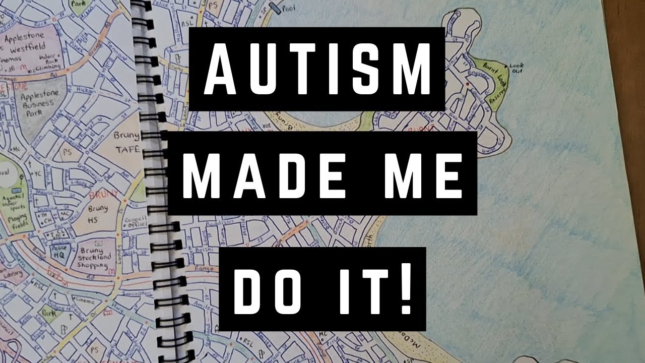
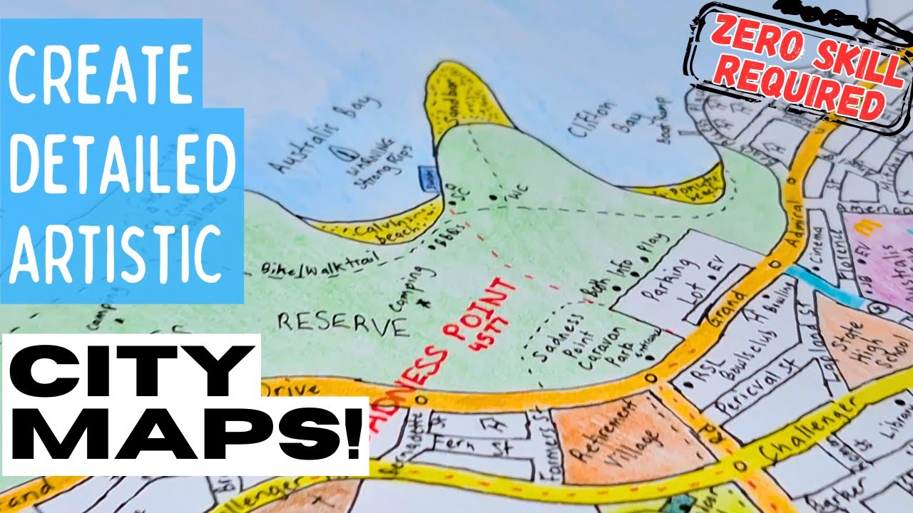
#mapping #citiesskylines2 #geography #maps Join me on a fascinating journey through my passion for Cities Skylines and how it intertwines with my autism. In this video, I'll take you through my meticulous process of hand-drawing 112 maps and organizing my entire dictionary based on numeric letter values. Discover how mapping and autism complemen...
thats awesome
just found an old sketch book haha, heres a DDI i sketched up back in 2021

highway transformed into a motorway

looks nice
Awesome! I used to do intersections ALL the time. All my old secondary schoolbooks were full of them, I got so many detentions cos I just never did the work 😭
3 days work. I love how this turned out. Any criticism?


The outlined blue blobs on the side of roads are bus stops
looks great! my only question is, what's the topography like? since im assuming the airport is on flat ground, is it in a valley, a plateau? are the taller elevations further west, tapering off to the east? the road layout would make sense for any of those, really. just curious :)
It’s a natural valley that was also artificially levelled off to make it suitable for the addition of a runway. The west side is flat hence the majority of the urban area being there. To the south and southeast it gets hilly, and same with the east, and the whole northern part of the main island has some pretty spectacular and striking mountainous rock formations hence the winding paths and roads, and more sporadic road planing in that far northeastern town. All of the island apart from the centrewest is encompassed in rugged but shallow cliff faces, interrupted by gorgeous secluded beaches and coves. There’s very little forest coverage on the island, except for the far northwestern tip which has light coverage. There are no permanent rivers or water bodies on the island itself.
The smaller island to the south is almost completely flat and sandy, but stable enough for development. In the past the settlement was a little larger but due to rising sea levels some residents were evacuated and provided housing elsewhere on the main island, and the roads were returned to nature. The population on this smaller island, however, is slowly declining due to the rising water levels, and the main promenade by the beach in the capital ‘city’ is at risk. The local government has implemented groynes to combat the swash & backwash, and riprap installed on some parts of the beach to combat the gradually imposing waves.
^ interestingly the runway is however on a very slight slope of around -1.7%
Now complete with bus routes


Thas acc certiiii
Certi?
Not badddd
Yoo u acc willing to do tha?
Same bro I thought I was the only one before I made this forum/thread I didn’t expect it to get this much exposure ibsr bc people ik irl don’t do shi like this 😭
Tha junction up top is acc very creative ibsr
How tf do u make 2 diff maps tha are the same? 😭
Ohh haha my bad I’m a bit slow when it comes to slang/colloquial terms
Thank you though :)
So I ofc hand drew the main map, then I photocopied it in black & white so that I could mark the bus routes with sharpie. It didn’t turn out that good but it does the job lol
Thas fineee not much people know tbh
Oh shiii Thas a sick idea I’ve always struggled w doing tha bc I wanted to do bus routes with one of my drawings but I couldn’t think of an idea
Thank you
Quick question, I’m a junior in high school and I have no experience drawing cities, anyone mind teaching me how?
This is the best I’ve done


i cant be much help since i rarely do my fictional mapping on paper, but id recommend using a straightedge more, and for inspiration you can look around the real world on google maps and see how things are structured, and how large things are in comparison to other things.
when drawing out settlements, it can be useful to think of the history and geography of the area. how long has this place existed? are there any geographical barriers? why was it founded here, and not there? if you want to add buildings, you can think of what you would need if you lived in a certain area of the town, taking the population into account as well.
hope this helps
Aight thanks
Welcome to my ultimate guide on creating your own Paper Map City! This comprehensive tutorial covers everything you need to know about designing and drawing a city map from scratch. Learn how to establish road hierarchies, connect maps, plot train lines, and manage urban density. We'll also walk you through designing highways and interchanges, d...
I just found this and it looks amazing
I’m using this for my first every city

Wish me luck ig
good luck!
everyone draws cities differently
especially from my experience on here
honestly, i took a lot of inspiration from the towns i saw on google maps
i used to make these google maps style renditions of cities off the top of my head
dont do it as much as i used to, ive been preoccupied with other things with life
Aight guys here’s the first part of the metro region of northocia

pretty neat
you should make the coast less circular
look around on google maps for the kinda coast youre looking for

pretty neat
yep
nice
This is really cool! My advice would be to lightly shade in your buildings, as they're difficult to distinguish from the local roads currently
Alright!
Guys I’ve done like 1/5 of my city


pretty cool
i can see the improvement over time
especially with the river and coast
Yeah thanks
I also decided to not shade in the buildings, I just don’t like the look
Looking good man!
Flood protection budget is through the roof
Thas acc so good
But some advice js trust the process and slowly u will get better and also find ur preferred style
For example my preferred style is this

Which does fit in more city space compared to the style u use
Are you supposed to use rulers when drawing roads/rivers or
i wouldnt recommend using it for rivers since they're never perfectly straight
but for road yeah
K
Also how do you draw trees?
Like densely forested areas
I usually use hashmarks
And fields(not farm) I use circles
U can use rulers but not overdo it
I usually js colour it in w dark green pencil
colored pencils are mid imo


Just a few new additions to the city along with a smaller town outside Greenville
I use colored pencils and they work great
Those are all of the tools I use


It’s based off an alternate version of St. Louis where an ocean was right next to it

st louis arch in st louis
Does anyone have recommendations for drawing a coastal Maine/New Hampshire shore town? Something like Odiorne Point
Or Wallis sands
Go with Cape of Saint may
Oh fair enough man
Should I trace?
What are you tracing?
Trace wha?
Like in general
Ohhh well u shouldn’t trace fully u should come up w ur own ideas but tracing can be used for ideas but if u want a good map or city then js use it for inspo not solely copy paste


New project coming together really well

Dang dude that looks good
nice
damn, really cool to see the progress!
I wonder if I should label each building since it’ll only be a small map really
Nothing hi rise
Depends on the space u have
On my maps I usually label the high rise w numbers and the O means office and blank is js apartments or multi use but when it comes to houses I don’t label them as the space is too less to write anything
And js Color code small shops w Maroon
What do you do for the highways?
I don’t think you could pull that off with doing one line
Copy it
Fill in
And then repeat that
It does usually work and I colour it in dark blue to replicate UK motorways

Similar to something like this
Icl it does fck up the scale sometimes but I can usually fix tha and it isn’t that noticeable
You mind sending me a few tips on how you make your cities? I kinda wanna learn
Yeah ofc lemme js make a list of my best advice
Aight
Check pc bro


Thas acc really good
Lauderdale City, Dawson, Purnell-Dave, Davison
Smallish town with a railway and 2 industrial sites

Meant to be dense and somewhat poor (except for a small part in the East)
I tend to struggle with density and wealth shifts so I had no idea what to do
larger blocks and larger houses mostly
i struggle with it too, especially when it comes to the roads
Hmmm i might use some of them for my next project


Here is an expansion of my last project
I didn’t get to finish my last project bc I wanted to make a section simialr to Stratford City in London
I usually get my city names from actual streets and my county names from cities.
Fair enough thas also a good idea but I usually go for unique names
started work on a capital city


nice, like the bay, looks realistic
thanks
Thas looking good
I might make an American style city after my current project 😭
Nice natural features, are you planning a port or something?
i actually hadnt thought about where to put the port
probably one or two sheets of paper north
the natural harbor would be just south of that southern grid
but it’s way too small for a modern industrial-scale port
Just finished tile 1. Will probably put this as the middle tile

I tend to use Pencils a lot to.
I see my maps as art and the scaling is never perfect but thats ok becuase for me its art
Thats looks amazing
interesting I always struggle with names I can never make up my mind.
That looks like a western US town in the mountains
Pencils are really useful Icl it’s js if I leave the map out for a long time it kinda js rubs out overtime and I have to go over it again
Same fr
I wanna make a map similar to tha. As in similar I mean no buildings but still looks built up but idk how to replicate the houses
How do you draw so many thin lines and not smear them on the paper
Do you use rulers for most of the drawing or freehand it
Freehand it, always, it looks weird when its all precise but some parts are by hand, so to avoid this just draw by hand everything and it will be coherent
how do you get started from a blank sheet of paper
it just seems really hard to create a good city when starting from scratch
without terrain or any other geography to guide the layout
Try to recreate what is already here, look on maps
Good city doesnt exist, in every city there is that bad neighborhood, or bad urban plan, or bad architecture, so just imitate what is in real life
Take inspiration from any city you want your city to resemble
How do you get the scaling more accurate
or do you just not worry about it
so like scale models or just resembling the city layout of a certain area
id argue the physical geography is the most important thing to think about when starting a city. is it hilly, mountainous, flat, in a valley? more often than not the town has to be near a water source as well.
you also have to think about flooding. this is a big problem for towns situated more downstream on rivers, or in large flat areas. the cities that are founded in these areas only expand on one side of the river, since all the flooding is concentrated on the opposite side.
an important question, too, is why was the city established here specifically? why not 10 miles north or 10 miles south? the location has to be better than most places nearby, or there won't be enough growth to justify a large population.
if the city was founded later, you could justify having a less advantageous location by having important railways or highways pass near the center of the city.
how do you do rivers in open geofiction
the water looks so splotchy


and i cant fill in a certain area
and have to put multiple layers in order for it to work
is there any way to make a large water body by filling it in instead of having to put each small layer in the same shape
how do yoyu make isalnds
sorry for asking the questions here
couldn't find any page on the wiki about watert
Think of it as art. Really its a peice of art not an engineering drawing it doesnt need to be 100% accurate. some times just drawing randon lines and then filling in the smaller spaces with different street patterns. No city is built on a blank slate so I start with drawing the core. Say you start a railroad town along a mainline on a gridiron. or a town on a coast or river bank. you kind of have to imagine the land scape in your mind and project it onto the paper so you can emagine what is this city going to do how transport connections will it have etc... Then start to draw a rural road network around the established core town and maybe other little villages. and more railway lines. then I start drawing in industrial parks and extend avenues to develop street car suburbs and have the grid as different angles fallowing old farm roads becoming streets. Then as I move forward in time and the map is starting to fill up I begin to add more highways which might include some erasing and subdivisions.
as you are drawing you are telling a story to yourself.
Its like Cities Skylines the vanilla maps are bad. but even the better custom maps your given a blank slate. Which I find to be challenging. I find it more fun to grow a city in an already populated region and swallow up all the little towns to become one large city. Other wise its just a car oriented mess. Plus when you are drawing on paper you don't have that stupid zoning grid to get in your way.
I have some drawings that are a collection of random towns in the midwest to mimic flyover country.
you have to make a multipolygon relation
I make a big grid of farm roads then railway lines at random angles
What the heck software are you using. I have to use traditional art supplies I have a hard time being creative on digital platforms. Although I do some times take a photo of a drawing and trace it in Ibis paint with a stylus on a tablet.
he is using https://opengeofiction.net
OpenGeofiction
OpenGeofiction is a user-made world map of a fictional world, created using the OSM software platform.
meh... I looked into doing that a long time ago and didnt care for it. I have too many pancil paper project to care
I find that when i draw on paper with pens it just looks bad
i end up accidently smearing the ink when i draw
You as the artist have to find what looks right for you
i can DM you the discord server for opengeofiction if youd like
sure
more pecil smeers it means I have a denser area with more buildings its part of the esthetic. again I see it as a work of art
In terms of scalling. I would say you should decide are you drawing a reginal road map or a specific town. is your scalling are style small and streets a re simple lines are you you drawing in all the lanes sidewalks buildings etc. there are many styles you can go for.
But in the last 5 years or so I've done less and less map drawing as I've gotten into vehicle/monster biomech design to further exercise my creative muscles.
I usually freehand it but use pencils Tha don’t smudge often
Nicely said fr
Real shi plus I don’t rlly get how to start on geofiction
Im old school I enjoy using paper and pencils gives moe satisfaction in creating art. My maps have been at several art shows when I was in School.
Now adays I do very few maps and I do mostly weird biomech creature design stuff and some painting.
Yea same man lich I don’t rlly do digital stuff but Thas also bc I haven’t found the right software. I’ve done some work on scribble maps but it ain’t satisfactory and I js keep tha for other things like lane marking or smt
Plus paper is much easier and accurate and I can do any scale, any style w no limitations
I haven’t had any of my art shown but I used to be known for my drawings and many people did like the drawings
Honestly looking back. I’ve changed my style sm and even this thread has seen it I used to js use squared paper and then lined and now blank. Paper is sm better but in terms of actual detail I think digital would be easier
Sure same say digital is more accurate and less messy and for some its faster but I still get no satidfactory from it in the end but if your a concept artist you have to draw digital its a industry standard and understandably so. When you draw digital your input is data archived and then they train the AI off you LOL.
Yea see I prefer paper bc even if digital is faster for
Some people it still takes time to get used to and be more neat in terms of design where as paper u can take the pencil wherever u want but Icl I’m still open to trying digital
interesting way of thinking about it
I mean theres a very low chance that ai would get trained off of fictional maps on the internet
most of them are pretty bad (like mine)
when they could just copy some actual cartographers map
anything you post on the internet still has a possibility of getting used for training ai