
#The Impossible Geolocation
41 messages · Page 1 of 1 (latest)
It has to do with some tests i’m running to check the usefulness of a new geolocation method i’ve been working on, i want to see just how much closer i got than others would get using normal approaches
Feel free to ping me with questions for more information about the image as well if you get stuck at a certain level of “zoomed in”. I may or may not give the info
||Portugal?||
Nope, although i’m curious why you guessed that since it’s an option also in my test method at first glance
@steady hemlock in case you’re bored ^^
Too hard for me.
🫡
The hint i sent in the reply might help if you can figure out how to use it (the idea is that its pretty much unsolvable to any extent without that hint)
||Çeşme or somewhere in SW Turkey?||
nope, curious how exactly you calculated it though
|| Random scrolling on suncalc and guessing ||
right approach, wrong solution
||did you measure the shadow length and scroll till you found a match for the shadow length?||
||(in that case its probably just a measuring error that gave you the wrong solution)||
nope, just guesstimated time of sunset etc.
there's a better way to do it ||with suncalc :)||, but you were on the right track
I'm more into brute force than being smart 😂
hah yeah but you gotta brute force the right way, want me to spoil the answer with the proof in dms (or do you want to try again)?
Will have to give it a few more tries, I guess. || Ireland, Scotland, or western UK-ish ? or maybe WC Norway ||
Very good
||Norway should be measurement errors but not that far off, so yes||
@rare sorrel Northern hemisphere?
Yup
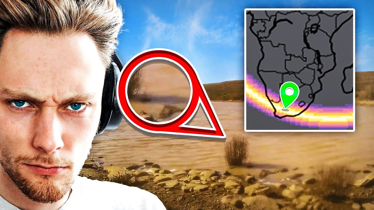
for the interested to see how i got it narrowed down a little better

different shadings means error ranges, but in reality because we're cool i actually had 0 error in the measurement (up to the 2 decimals at elast). So you only need to look at the brightest yellow for the potential options (technically only the center of the brightest yellow parts but i can't make the map show those ranges yet)
well only really @steady hemlock probably lol
I went a different route. There are several coniferous evergreen trees visible in the background. This does not look like a garden or park so my assumption is these are natural.
On this map that would be dark or light green areas
Also the little shrubs on the left look very wind-swept that would point me to either coastal or highlands area.

If you combine it with the map you posted I would be inclined to say || coastal washington/oregon (though my gut feeling is this does look very us like) uk/ireland or baltics ||.
Gut feeling was right))
But i like your approach
This video i made with rainbolt and a Bellingcat researcher shows the idea i had that i sent this challenge for (as comparison to see how doable it was without this added info)
tool here: https://colab.research.google.com/github/GalenReich/ShadowFinder/blob/main/ShadowFinderColab.ipynb
ty again to gabor and galen for being apart of this video, and their contribution to the tool
galen: @galen_reich / twitter
gabor: @gabor_friesen / twitter
||Ireland?||
Close but not quite
It’s actually ||dartmoor national park||
Ahh
found this "geospy ai" tool, it does go ireland here
I mean it makes sense, the geography is similar in some ways
yeah
I’m fairly certain I’ve been here. Trying to use the spoiler but it’s not working.
Dartmoor national park