
7 messages · Page 1 of 1 (latest)
 lapis flower
Was following a tutorial here:
https://medium.com/@alex_44314/use-python-geopandas-to-make-a-us-map-with-alaska-and-hawaii-39a9f5c222c6
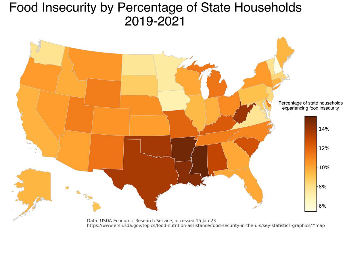
However, when I perform the same code, I get the attached pic with Lake Michigan and parts of Lake Superior/Lake Heron are also filled in. How do I ensure that only the landmasses are populated using geopandas? Tried looking at the documentation, but only complex examples are shown for nuanced use-cases.
Here’s one way to make a static choropleth map using geopandas and matplotlib.
 pliant yachtBOT
lapis flower
Was following a tutorial here:
https://medium.com/@alex_44314/use-python-geopand...
pliant yachtBOT
lapis flower
Was following a tutorial here:
https://medium.com/@alex_44314/use-python-geopand...
@lapis flower
 Python help channel opened
Remember to:
:warning: Do not pip install anything that isn't related to your question, especially if asked to over DMs.
 static trail
lapis flower
Was following a tutorial here:
https://medium.com/@alex_44314/use-python-geopand...
static trail
lapis flower
Was following a tutorial here:
https://medium.com/@alex_44314/use-python-geopand...
unless you have some column in your dataset indicating whenever a given geometry is a landmass or not, geopandas has no means to know what each part of your data refers to
if you somehow do have such as column, filter to remove it before plotting
if you don't (most likely scenario), you would need to modify the geometry - either manually editing the dataset by hand in some cartography program or by using geometries from a different dataset instead
lapis flower
So, as far as I understood from this tutorial, I matched up a State column to the Shape file(s). If I'm using the wrong shapefile, I'm wondering if that's somehow the source of the issue here. I appreciate you taking the time to respond!
I'll look into that. I'm thinking that might the variable there I hadn't considered.
pliant yachtBOT
 Python help channel closed for inactivity
This help channel has been closed. Feel free to create a new post in #1035199133436354600. To maximize your chances of getting a response, check out this guide on asking good questions.