#My Map Ideas For JDM2

28 messages · Page 1 of 1 (latest)

untold marten
#

I have finalized my idea to some extent, but it is annoying to write in other people's thread in large numbers, so I will move it.

A – Industrial zone inspired by places like the Yokkaichi Kombinat. A perfect stage for drag races.
B – The main urban core that comes after the industrial belt (separated by some residential areas). A ring road weaving through high-end skyscrapers, with landmarks like a Ferris wheel and red-brick warehouses.
C – Hillside residential district. I want to give it a Japanese-style San Francisco vibe to make delivery missions more exciting.
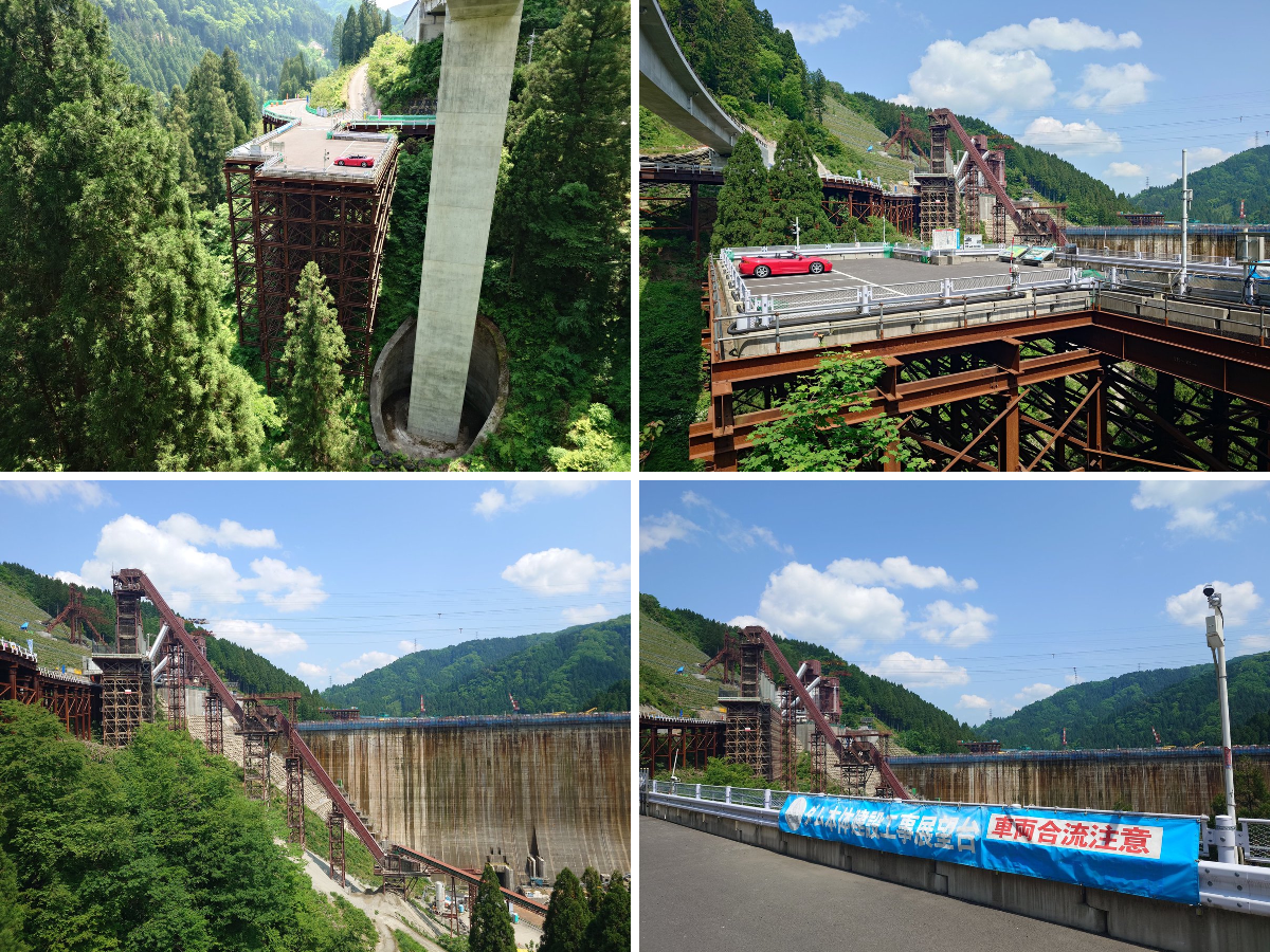
D – Dam perimeter circuit. Make the contrast strong between the open, liberating feeling on the embankment and the closed-in tension of the mountain roads.
E – Run-down fishing village. Weathered, rotting guardrails and old houses that give a strong sense of atmosphere and melancholy.
F – Ancient capital inspired by Kyoto. Areas with well-preserved old town blocks.
G – Hot spring town. A place with drifting steam that also serves as a hangout spot for street racers.
H – I’d like a course that goes all the way to the crater of a volcano, like a Japanese-style Pikes Peak.
I – Artificial island with container yards, etc. It could also work as the exit of a subsea highway tunnel.Perhaps adding a landmark tower similar to Kobe Port Tower or Yokohama Marine Tower would work well.

untold marten
#

Introduction:
This is mainly a collection of places that I personally would like to drive through, so if you asked the same question to other people, you would probably receive completely different answers. Because of that, please treat this purely as my personal opinion and use it only as reference material.

That said, there are a few things I really hope will be respected:

  1. Each area should have a clear theme, and the townscape should remain consistent with that theme.
    For example, imagine someone wanted both sushi and cake. If you poured vinegar onto cake batter, placed fish on top, and then added whipped cream, the result would be neither sushi nor cake, but simply a failed dish.

I’d like each region to have a distinct identity, such as:

“An old capital with preserved historic streets”
“A village trapped in eternal snow”
“A major metropolis serving as the center of economy and culture”

  1. The transitions between regions should feel as natural and seamless as possible.
    For towns used as inspiration, especially urban areas, I’d recommend studying places around roads like National Route 1 and other major highways through tools such as Street View.

  2. Clearly distinguish expressways, national highways, local roads, and forest roads.
    If Japanese expressway toll gates, parking areas, and service areas could be recreated accurately, Japanese players would absolutely lose their minds with excitement. Games like Tokyo Xtreme Racer could serve as good reference material.

  3. If there’s anything you don’t understand, please ask to we Japanese. Anywhere is fine, whether it’s Discord, Twitter, or something else. We’d be happy to help.
    For example:

“Does this road sign design look correct?”
“What kind of town would people like to drive through?”
and so on.

untold marten
#

Area A: Coastal Industrial Zone

A seaside industrial area with plenty of long straight roads, making it ideal for drag racing.

① Petrochemical Complex
Inspired by Yokkaichi’s industrial complex. Add a coastal road modeled after the Yokkaichi Inaba Port Line running alongside the sea. Perfect for night view photography and scenic drives.
② Seabed Tunnel to Elevated Highway
From the undersea tunnel (coming from Artificial Island I), connect smoothly to a three-lane elevated expressway. Modeled after real-world bay coastal routes.
③ Port and Wharf Industrial Area
Dockside industrial zone with wide open spaces. Great for drifting,drag racing and technical driving.
④ Large Signature Bridges
Grand bridges like the Bay Bridge or Tsubasa Bridge. Perfect for high-speed runs at full throttle.
⑤ Major National Route Bridge
A large bridge inspired by structures such as the Ibi-Nagara Grand Bridge(揖斐長良大橋) or Ise Great Bridge(伊勢大橋).
⑥ Residential District (Green Area)
The green-colored zone is a residential neighborhood. Mix in a stadium (athletics track) and a driving school (perfect for tutorial missions).
7 Massive Shopping Mall
An enormous Aeon-style super shopping mall. The vast parking lots can be used for gymkhana events, while the multi-story parking garages are ideal for car meets and night gatherings.

#

My Map Ideas For JDM2

untold marten
untold marten
#

今回は四日市港に2018年に開通した「四日市・いなばポートライン」を通っています。高架道路で見晴らしが良い道路です。本当は夜景が綺麗な場所なんですが、手持ちのGoProでは夜間撮影が難しいので暗くなる前に撮影をしています。

走行区間:https://goo.gl/...

▶ Play video

夜の四日市港へ行きました。
いなばポートラインを走って、写真を撮ってきました。

▶ Play video

湾岸線の西行きを運転してますと、海底トンネルをいくつか潜ります。
そんな時に河口って川幅広いんだなっていつも感じます。

▶ Play video

2004年1月1日撮影
挙動不審、長谷川軍団、ガゼルパンチ、D1GPに出場した人もいますね。
2021年現在のD1GPはJAF公式戦になっており「一般公道にて暴走行為を行うなど、社会的違法行為に及んだ者などについてはライセンスが剥奪される」・・・としています。

...

▶ Play video
void trellis
#

Now that's super interesting - thank you for sharing your awesome ideas 🗺️ !!

untold marten
#

Area B/I  
This concept is loosely inspired by places such as Yokohama and Kobe, though I am not deeply familiar with them, so this should be considered only a rough draft.

A waterfront urban district lined with business towers and luxury apartment complexes.

1
Airport area. It might even be interesting to include oval races that make use of the runways.

2
An expressway overlooking the container yard before descending into an underground tunnel.

3
A city district filled with high-rise hotels and landmark towers.

4
A double-deck bridge inspired by structures such as the Kobe Bridge or the Higashi-Kobe Bridge.
(The real Kobe Bridge actually uses the upper and lower levels as one-way national roads, but in-game it might work well to make the upper deck an expressway and the lower deck a normal highway.)

5
Perhaps the harbor could have a backstory of once being an old ship dock, allowing vintage ships to remain moored there, or alternatively modern cruise ships could be docked directly at the port.

6
Large piers extending into the bay, with landmarks such as red brick warehouses and a ferris wheel placed on top of them.

7
A Chinatown district featuring a red-dominated color palette and streets lined with Chinese signboards.

8
Near the residential districts away from the business center, there should be an old-fashioned covered shopping arcade with a nostalgic atmosphere.

9
I would like the urban expressway network, inspired by routes such as the C1 Loop and the Hanshin Expressway loop routes, to become a highly technical course filled with uniquely urban gimmicks.
Things like highways passing directly through buildings similar to the TKP Gate Tower Building, or dense concrete bridge supports reminiscent of the Ginza section of the C1, would create a memorable metropolitan driving atmosphere.

untold marten
#

I’d like to see business districts and upscale residential areas inspired by places like Yokohama and Kobe. However, to build those areas convincingly, I think it would also be important to use major cities such as Tokyo, Osaka, and Nagoya as references, along with other port towns like Kure, Shimonoseki, and Nagasaki.

untold marten
#
untold marten
#

Area C: Basically just a residential neighborhood—I’d love to see a car chase mission that takes advantage of the steep slopes.

  1. Exotic 19th-century European-style architecture
  2. Two residential neighborhoods along the national highway
  3. A mountain pass inspired by the Ura-Rokko and Omote-Rokko Driveways—beyond this mountain, there should be a hot spring town or small town similar to Area G.
untold marten
#

芦有ドライブウェイを芦屋~宝殿区間で走ってきました♪本当は有馬まで行きたかったのですが日没が迫ってきていたので今回は宝殿までにしました!カメラが古いので夜の動画がなかなかうまく撮れません。夜の走行動画を綺麗に撮れるカメラの情報募集...

▶ Play video

紅葉シーズンの六甲山を撮影してきました!BGMはPSのゲーム「峠MAX」の甲田山のBGMにしています♪甲田山は六甲山をモチーフに作られたコースなので良い感じに曲がハマると思います♪

▶ Play video

裏六甲ドライブウェイ上りです♪工事区間が多かったのでそのうち撮り直ししたいと思います!BGMはPSのゲーム「首都高バトルR」から頂きました♪

▶ Play video
untold marten
#

From Area B to Area E, I would suggest the following progression:

①Continue a coastal national highway similar to National Route 134.
②Have the national highway and expressway intersect and run alongside each other, similar to Yui.
Then pass through a mountain road reminiscent of the Ise-Shima Pearl Road before arriving at the port town.

https://www.youtube.com/watch?v=jIIl2P7fH9M&list=PLIxddc7lWglJecSGGieSMuYkv0TSirBmZ&index=1
https://youtu.be/4JOaoFFErt4?si=NGde1iRPiqSRf3Q-&t=407
https://www.youtube.com/watch?v=kUj_qDv8Kxo
https://www.youtube.com/watch?v=UHL8DKtbgwg
https://www.youtube.com/watch?v=zzh9CD1Wmz0

https://maps.app.goo.gl/8KtJqBB4DtormYb79

※初期の動画ですので、解説短め、車載動画長めです。ご了承くださいませ。
○野比と野比のび太の関係は? 07:32
○よこすか海軍カレー! 01:24
○すかなごっそ? 16:44
 等々

神奈川県の「国道134号線」「三浦半島」を解説。
横須賀・三浦・葉山・逗子...

▶ Play video

いつもご視聴ありがとうございます。

今回は伊豆・箱根を離れて国道1号線の富士由比バイパスから静清バイパスをドライブします。

【撮影日】2022年6月29日
【カメラ】 GoPro HERO 9 BLACK + K&F CONCEPT 可変NDフィルター NANO-X(ND2)
【設定】
     2...

▶ Play video

【本日のルート】
東名高速道路ドライブ【由比PA-浜松IC】
https://goo.gl/maps/28Nhf7wUMchirfxS9

00:00 東名高速
01:19 由比PA
04:05 清水JCT
04:30 清水IC
07:08 日本平PA付近
08:09 日本平久能山SIC付近
09:03 静岡IC付近
11:04 日本坂トンネル付近
12:27 日本坂PA付近
13:06 焼津IC付近
15:47 ...

▶ Play video

※機材トラブルの為、ノイズ多めになってしまっています。
ご迷惑をお掛け致しますが、ご容赦ください。

パールロードは、三重県道128号鳥羽阿児線の通称で、かつては有料道路として多くの人々に親しまれていました。志摩市の三重県道16号南勢磯部線と...

▶ Play video
#

3,4 
 Do you remember Air? The town is essentially intended as a tribute to the setting and atmosphere of that.

The concept is a slightly weathered seaside town that evokes a strong sense of nostalgia: small family-run shops, aging streets, rusted guardrails, and the quiet feeling of a place that time has gradually passed by. Rather than being a tourist destination or a bustling city, it should feel like an ordinary coastal town whose charm comes from its lived-in character and lingering memories.
 Towns like this often have their own folklore (such as mermaid legends). How about drawing inspiration from Japanese folklore to give the boss and other characters that kind of atmosphere?

#

Air de key por kyoto animation

▶ Play video

PS Vita 『AIR』
2016年9月8日発売

移植ラインナップ最高解像度&カラーリングを再調整。
幻の外伝小説「初空の章」をビジュアルノベル化して収録!

プロトタイプ公式サイト
http://www.prot.co.jp/

Key Official HomePage
http://key.visualarts.gr.jp/

▶ Play video
#

There should be several ways to travel from this port town to the old capital.

⑤ A truly extreme, expert-level mountain pass modeled after Kuragari Pass, so narrow and difficult that even passing another vehicle can be a challenge. However, the historic landmarks along the route and the breathtaking view overlooking the old capital as you descend the mountain can only be experienced from this pass.

⑥ The national highway continues through the mountains via tunnels, but there should also be an old mountain road for advanced drivers who prefer to cross the mountains directly rather than go through them. Wada Pass can serve as an example of this type of route.

There could also be a mountain pass somewhere along the journey between Areas B and E.

#

6年ぶりにマニュアル(MT)車で暗峠を再訪!日本一激坂で激狭な国道をMT車で走行したらどうなる!?
国道308号は大阪府大阪市中央区~奈良県奈良市を直線的に結ぶ、「暗越奈良街道」を踏襲するルートです。府県境を越える暗峠区間は最大斜度37%(20.3度)とい...

▶ Play video

6年ぶりにマニュアル(MT)車で暗峠擁する国道308号を再訪!日本一激坂で激狭な国道をMT車で走行したらどうなる!?
国道308号は大阪府大阪市中央区~奈良県奈良市を直線的に結ぶ、「暗越奈良街道」を踏襲するルートです。府県境を越える暗峠区間は最大斜度...

▶ Play video

岡谷市 国道142号 和田峠 和田宿 ドライブ 2022 May 3
Cam : GoPro HERO9
Music : Don't Throw Our Love Away (feat. Martin Novales)

▶ Play video
untold marten
#

Area D:A dam built in a mountainous area. There is a bypass road that crosses the dam’s embankment and connects the upstream and downstream sides. Perhaps a small settlement could exist there

untold marten
#

足羽川ダムのこっわい駐車場

矢作ダム ダム湖周回ビデオです
1周12分ペースです イメトレ用に

▶ Play video

矢作ダム ダム湖周回ビデオです
1周12分ペースです イメトレ用に

▶ Play video
#

兵庫県北摂地域の3つのダムと武田尾へツーリングに行きました。
前編では一庫ダムと貯水率が低い時にしか行くことが出来ない龍化隧道へ行きます。

【訪問先】
一庫ダム(兵庫県川西市)
一庫公園(兵庫県川西市)
龍化隧道(兵庫県猪名川町)

【通っ...

▶ Play video

兵庫県北摂地域の3つのダムと武田尾へツーリングに行きました。
後編では青野ダムと千苅ダム・武田尾を巡ります。
日本最古のスライドゲートを持つ千苅ダムではちょうど放流していて美しい光景を見ることが出来ました。

【訪問先】
青野ダム・千丈寺...

▶ Play video

奈良県道25号の布目ダム周辺は二輪通行禁止なのでバイクではいけないと思っていましたが、東側の道なら行けることが分かりました。

撮影日:2024年6月

【訪問先】
めえめえ牧場(奈良県山添村)
布目ダム(奈良県奈良市)

【X】
https://twitter.com/sakahosa534

...

▶ Play video
untold marten
#

Area F:Old Capital( ※Do not allow expressways within the city limits)– The entire city should be laid out in a grid pattern, with a river running through its center. On the east side of the river, there should be an area inspired by Kyoto, built as a riverside district.①

Along the main avenues that run perpendicular to the river—or just a little off them—there should be many shrines and temples, with at least one allowing players to actually enter the grounds.

On the west side of the river, just one street away from the main road, there should be an old highway town inspired by routes like the Tokaido or Nakasendo, with post towns and preserved historical buildings still standing as they once were.②

Following that road should eventually lead to the moat of a castle. Near the main keep, there should be a parking area where players can stop and take photos.③
 A village near the ancient capital (based on Ohara)
A town of rice paddies and terraced fields, featuring a mountain pass and a roadside rest area. It is home to temples that, while not as grand as Sanzen-in or Jakko-in, possess their own unique charm.④

#

Throughout the city, if possible, use muted colors for general vehicles as well (using primary colors or neon signs on buildings is generally out of the question), thereby eliminating any garishness even in urban areas.
Buildings along the main streets should be primarily light beige or white, while residential areas just off the main streets should feature wooden structures. Make sure to distinguish between Shinto shrines and Buddhist temples.https://www.city.kyoto.lg.jp/tokei/cmsfiles/contents/0000281/281400/HP-English.pdf

#
untold marten
#

One of the underlying themes of this map is that a single national highway connects the modern city to the old capital. (Like Route 1 (Tokaido)) It is similar to the Tōkaidō, for example. Including roadside stations and milestone markers along the way—inspired by the post towns of old—would help create a great atmosphere.  https://en.wikipedia.org/wiki/Shukuba https://en.wikipedia.org/wiki/Ichirizuka https://en.wikipedia.org/wiki/Roadside_station

Shukuba (宿場) were staging post stations during the Edo period in Japan, generally located on one of the Edo Five Routes or one of its sub-routes. They were also called shuku-eki (宿駅). These stage stations, or "stage station towns (宿場町, shukuba-machi)" developed around them, were places where travelers could rest on their journey ar...

Ichirizuka (一里塚) are historic Japanese distance markers akin to milestones. Comprising a pair of earthen mounds (tsuka or zuka) covered in trees and flanking the road, they denoted the distance in ri (3.927 kilometres (2.440 mi)) to Nihonbashi, the "Bridge of Japan", erected in Edo in 1603. Ichirizuka were encountered and described by Enge...

A roadside station (道の駅, Michi no eki) is a government-designated rest area found along roads and highways in Japan. Unlike Service Areas and Parking Areas, they are not on tolled expressways and can be accessed by anyone.
In addition to providing places for travelers to rest, they are intended to promote local tourism and trade. Shops may...

#
#
#
#